
E-MAIL: CSHULER@HAWAII.EDU
EDUCATION:
- PhD, Earth Sciences, University of Hawai‘i at Mānoa, 2019
FIELDS OF INTEREST:
- Surface and groundwater hydrology
- Hydrologic monitoring
- Modeling
- Data science
- Web-applications
RESEARCH PROJECTS
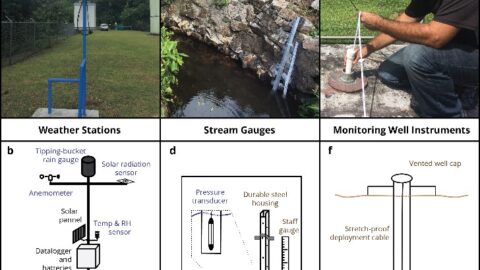
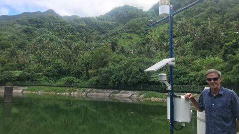
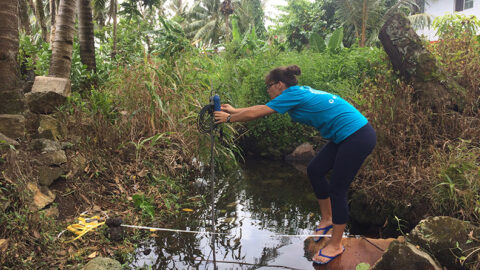
Hydrologic datasets are essential for the design of sustainable water supply systems and the prediction or detection of acute threats to drinking water quality or availability. We developed a hydrologic monitoring network consisting of 21 instruments including weather stations, stream gauges, and monitoring well dataloggers on the Island of Tutuila, American Samoa.
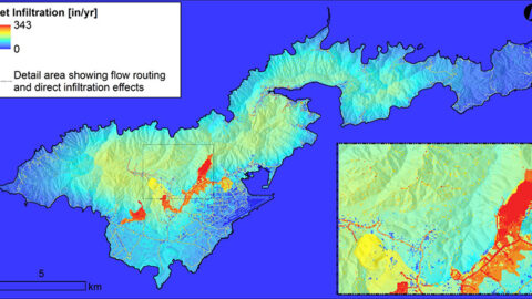
A water budget approach using the Soil Water-Balance-2 model was applied to Tutuila Island in American Samoa. We also assessed potential future change in recharge by substituting rainfall and temperature projections from dynamically downscaled climate global climate model predictions and possible future land-cover scenarios developed with local stakeholders.
This work presents a collaborative modeling framework developed by participants at the American Samoa Power Authority and at the University of Hawai‘i Water Resources Research Center. The framework includes modular components including collection and analysis of climatic and streamflow data and development of a water budget model and groundwater model.
We developed a dissolved inorganic nitrogen (DIN) loading model by integrating commonly available datasets within a geospatial modeling framework for Tutuila, American Samoa. The model integrated an open-source water budget model, water sampling results, and publicly available streamflow data to predict watershed-scale DIN loading to the island’s entire coastline.