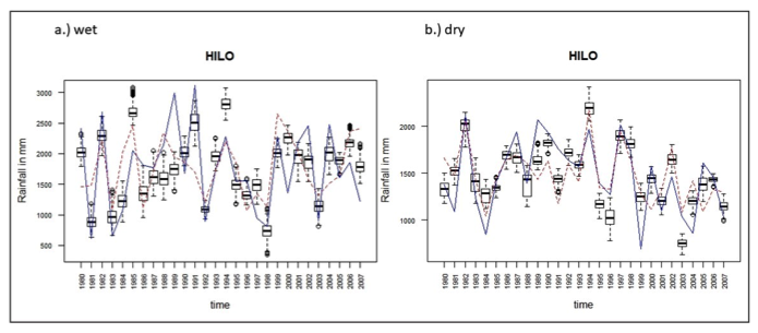
Project Category: Hydrological SciencesTrends In Hawaiian Rainfall: Detection and Attribution Studies Using CMIP6 DAMIP Multi-Model Ensemble
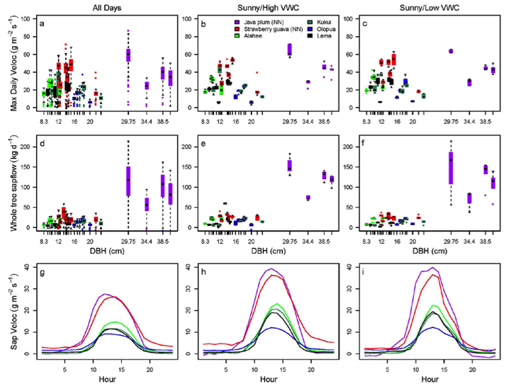
Project Category: Hydrological SciencesTranspiration Characteristics of Native and Non-Native Plants at a Leeward Ko‘olau Forest Site, O‘ahu, Hawai‘i
Project Category: Hydrological SciencesDevelopment of a Pilot Scale Water Resources Research Center Outputs and Products Data Portal
Project Category: Hydrological SciencesEvaluating Similarities and Differences Between Statistical and Dynamical Downscaling Projections
Project Category: Hydrological SciencesDevelopment of Digital Meteorological Surfaces for Modeling of Hydrological Processes in Hawai‘i
Project Category: Hydrological SciencesProjecting Near-Term Climate Variability and Change of the Main Hawaiian Islands to Provide Actionable Climate Information to Resource Managers and Decision Makers
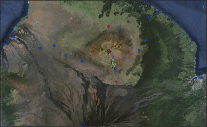
Project Category: Archived Research ProjectsImproving Water Resource Assessment in Hawaii by Using LiDAR Measurements of Canopy Structure to Estimate Rainfall Interception
Project Category: Archived Research ProjectsMonthly Rainfall Maps for the Islands of Kauai, Oahu, Molokai, Maui, and Hawaii, 2008-2010